Stage 3 Mountain Creek Road to Pabral Road

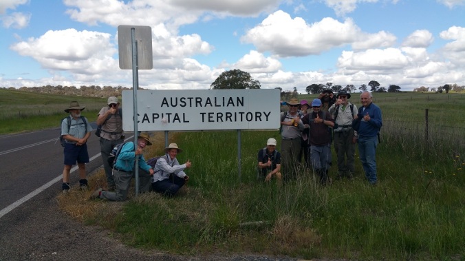
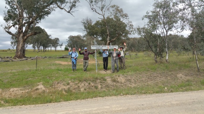
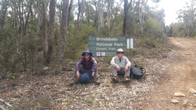
Stage Three of Walk the Border ACT 2019 will be remembered as one of the epic stages of this year’s fundraising event! And we’re only three days in!

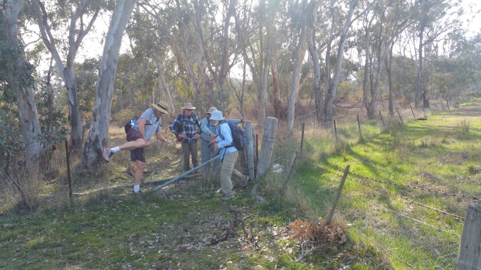
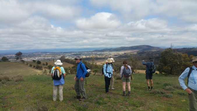
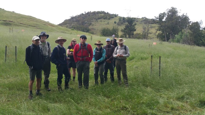
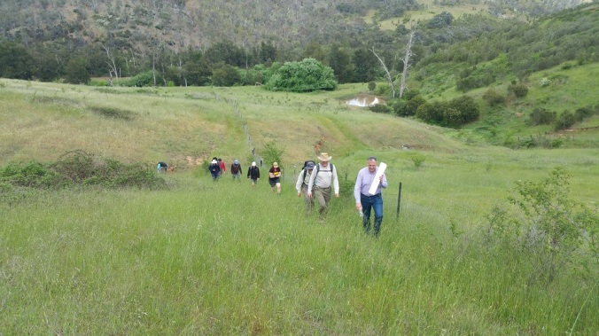
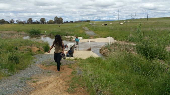
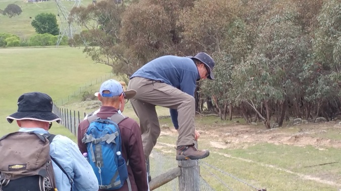
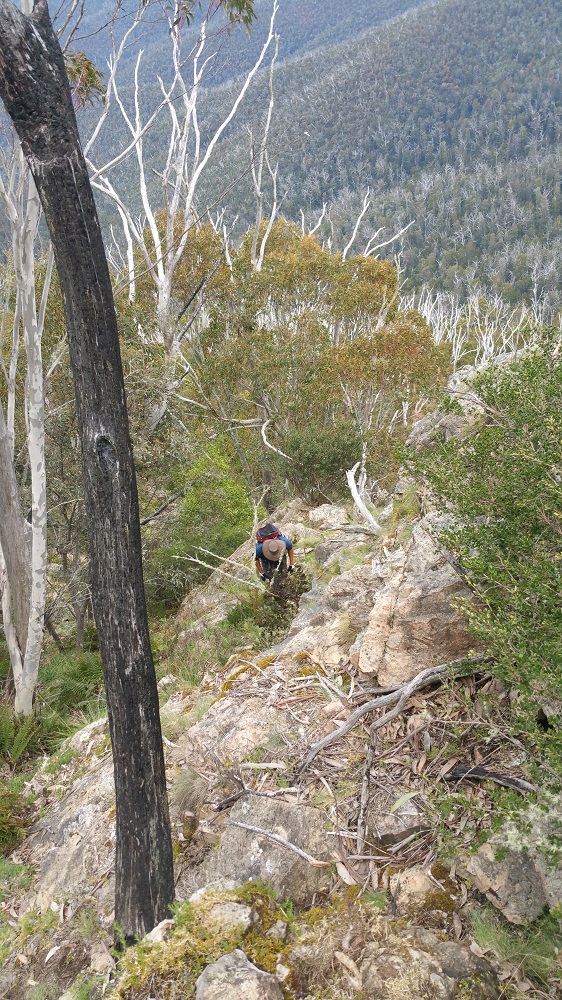
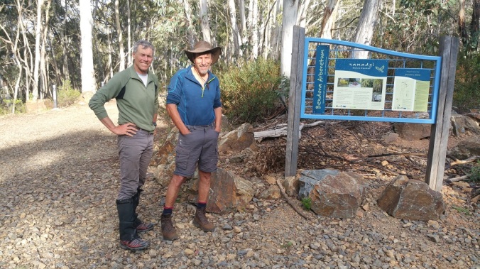
Five folks completed today’s walk that lasted nearly 10 hours, including an unfortunate diversion around an unexpected road closure.

Plus an extra walker came along for the first part.

20191007_091641

20191007_093625

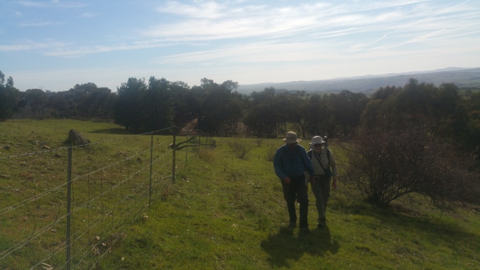
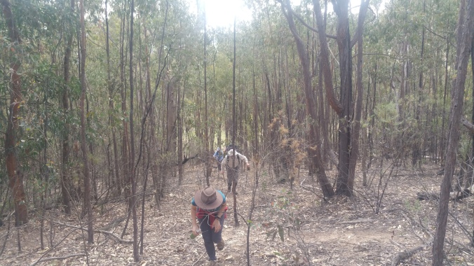
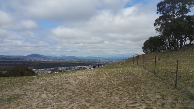
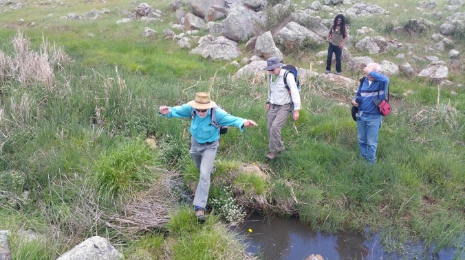
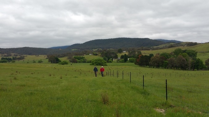
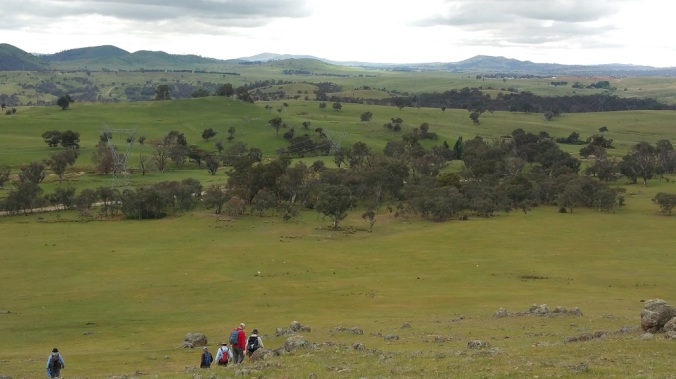
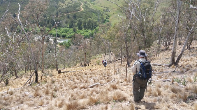
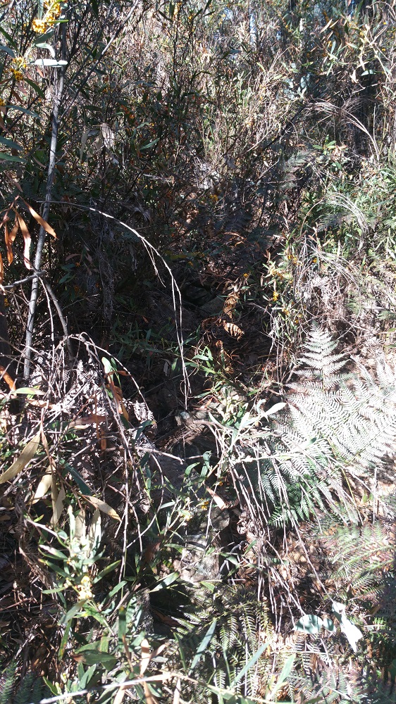
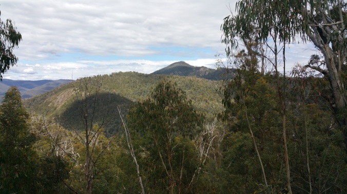
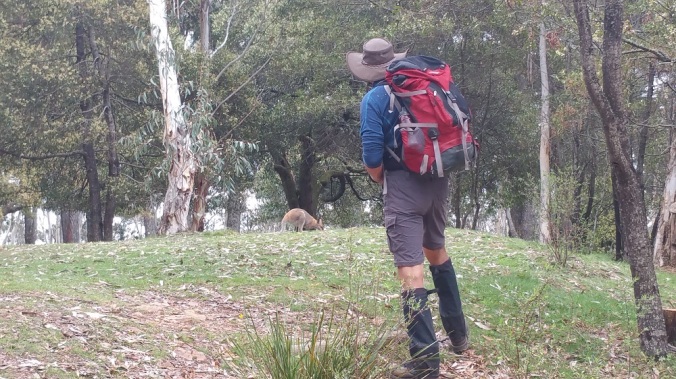
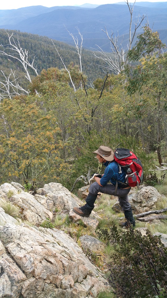
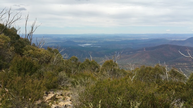
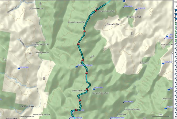
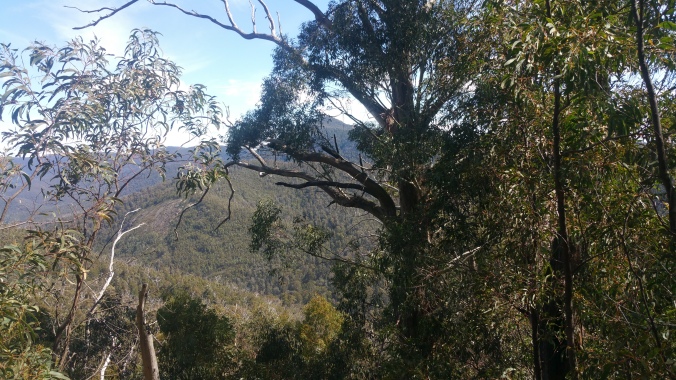
The thick scrub, big climbs. and warm day contributed to what was a very very, long day, however as always there was good companionship.  And some fantastic views.

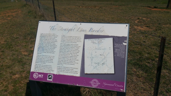
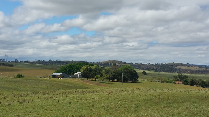
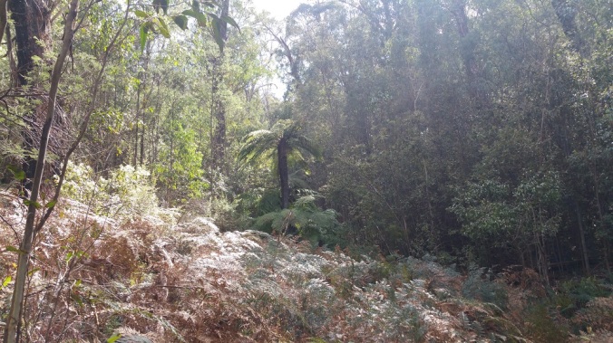
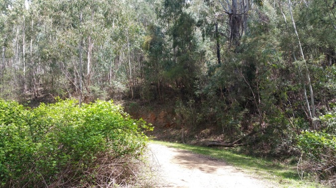
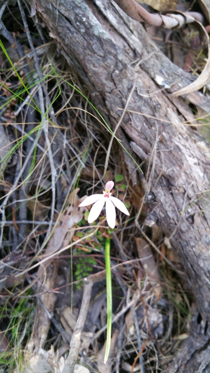
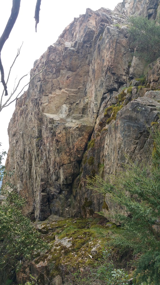
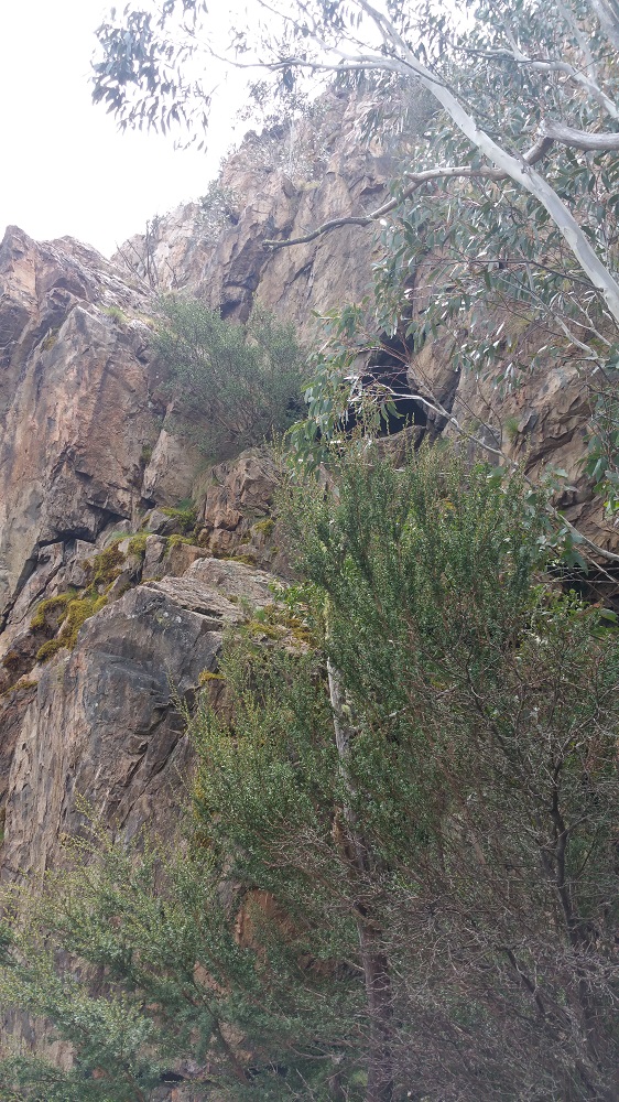
Along the way we trod paths rarely crossed by walkers, and was it a special day to experience the varied ecosystems of the northern stretches of the ACT.

20191007_104326

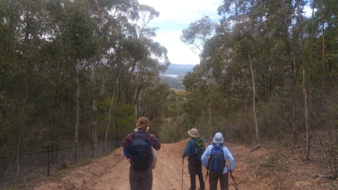
We could see the vegetation constantly change as we rose up into the higher altitudes and rarely visited spots of the ACT.

20191007_133436

Always in front of the party was Mount Coree, beckoning us on to tomorrow’s walk.

20191007_143645

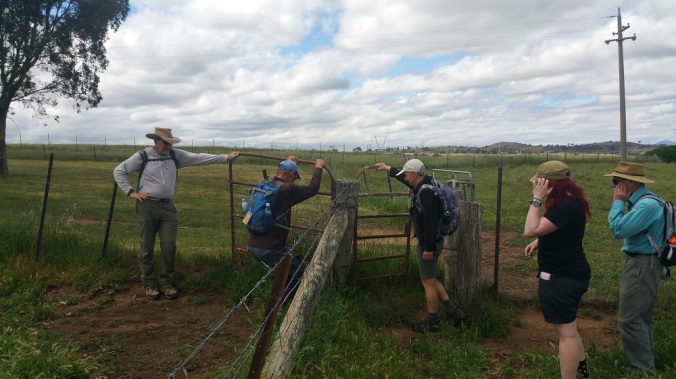
Thanks to Tom, James, Chris and Laurie for great companionship on a very tiring day, and Steph for her short term view of Walk the Border ACT 2019.

Stage 3 Map

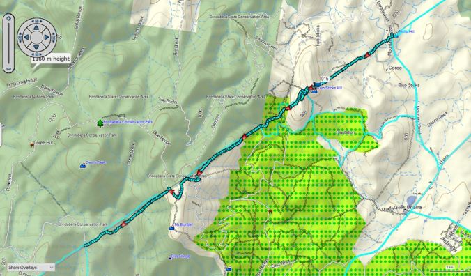
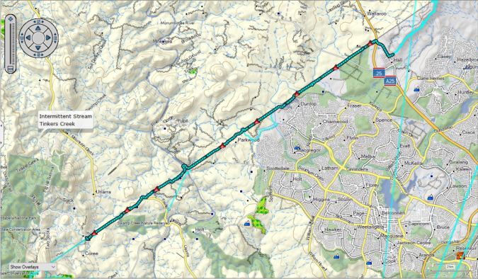
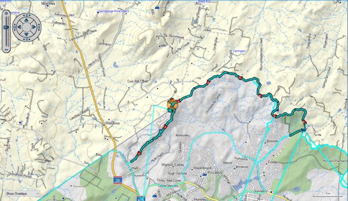
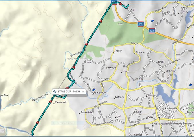
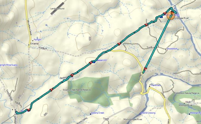
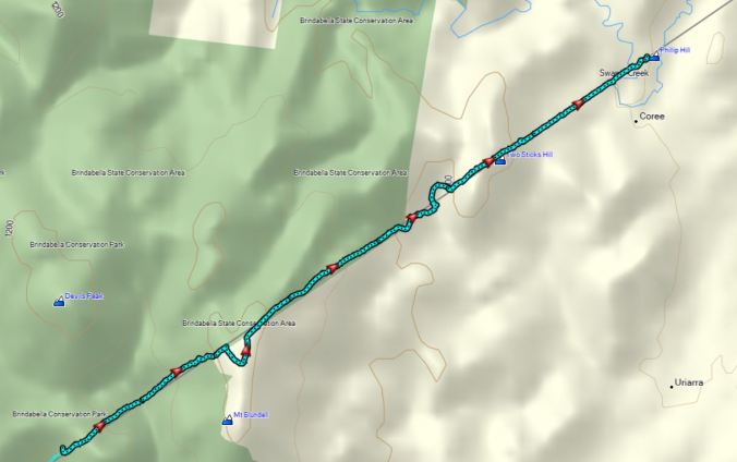
Distance 16.1 Kms (plus 4.2 Kms to get back to car) Ascent 1219 metres Descent 847 Metres

Stage 2 Hall to Mountain Creek Road

A fine day for Walk the Border ACT Stage two going from Hall To Mountain Creek Road The day’s 7 entrepid walkers followed the ACT’s western border through many kilometres of protected grasslands.20191006_095418

They encountered many dozens of fences but fortunately there were not too many torn clothes.20191006_092745

Highlights of the day included the numerous straight line border markers.  Placed in the ground over a hundred years by the original ACT surveyors, these long lines of rock guide the route for the day.  The walkers were also able to access parts of the border not able to be reached in 2017 due to the flooding of Ginninderra Creek.

20191006_113027

The crossing of the Murrumbidgee River by canoe was another highlight providing a bit of respite from the heat of the afternoon.

IMG_6262

A very hot and steep climb out of the river valley was rewarded by some fantastic views across the ACT ‘s landscape.

Over 40 different species of birds we sighted during the day from waterbirds on the many ponds to raptors patrolling the rivers and meadows.  Many thanks to Lia for her birding expertise.

Thanks also to Kris for her botanic knowledge and to the many landholders who gave permission to cross their land today, particularly the Gininderry development, the CSIRO and the owners of Homeleigh, Brookvale. Woodstock and Fairlight properties.

Stage 2 map

21.2 Kms.  7 Hours 604 metres of ascent and 662 metres of descent

Stage One Mulligans Flat North to Hall

The day started with overcast and rainy skies but soon turned into a day of pleasant walking conditions. It saw 32 people be welcomed to country by country by Wally Bell and then further inspired by the words from ACT MLAs Shane Rattenbury and Elizabeth Lee. The crowd also included three other members of the ACT Assembly, a true cross-section of the ACT’s political environment.

From the starting point it was a short walk to the border passing through the young woodlands of North Mulligan.  The walk follows the long skyline to edge of Oak Hill along the long skyline of far Morgan’s flat following the Zigzag Line of the border. So many fantastic views s into northern ACT and surrounding New South Wales. All very awe inspiring.

20191005_105057

After we got to the slopes of Oak Hill, those participants just doing the five kilometre loop left us and  we went down to 11 continuing along the full 16 kilometres to Hall.

20191005_110737

The reduced group were rewarded by many sightings of historic border markers constantly reminding us that we were following in the footsteps of the surveyors who shaped the ACT.  Other highlights included a number of shingle-backed lizards, echidnas, numerous birds and even a fantastic native orchid.

Some great company in good conditions on this first stage of walk the border ACT 2019.Stage 1 Map


Walk the Border 2019

It is on again! Walk the Border ACT 2019 starts on 5 October and reprises the
Conservation Council ACT Region’s successful 2017 fundraising walk, but this time in the opposite direction! Register here

The ACT border is 306 km long and crosses a variety of our ecosystems, from the majestic alpine forests to diverse lowlands, from endangered ecosystems to the urban environs. The walk is being led again by the Conservation Council’s president, Rod Griffiths who will be joined at each stage by a range of fundraiser-walkers.

The walk will start at North Mulligans Nature Reserve, following the border in an anti-clockwise direction. The route will take in some of the ACT's roughest and most beautiful country, including the magnificent land surrounding the source of the ACT’s water supply. Many stages are easy and accessible, and we welcome walkers of all levels to get involved. Check out our schedule to decide which stage(s) you’ll do. The walk will be exciting, challenging, and will allow those participating to experience parts of the ACT less travelled.

Why not sign up to be part of this exciting and important event? You can walk one stage or multiple, even camping out overnight.

For more details of the walk and each of its stages, as well as how you can get involved or make a donation, go to the Conservation Council website. We’re asking every walker to set a goal of raising $306 – one dollar for each kilometre of the ACT border.

This site and our Facebook page are great places to keep up with what is happening with the walk.

Day 21 Murrumbidgee River to Hall

What a big storm on the previous night! Lucky the Walk the Border ACT walkers were all home by the time it hit but it did still have an effect on Day 21.

We had a group of 11 starting off from the banks of the swollen Murrumbidgee River but the biggest climb was right at the beginning of the day.  We were assisted in getting to the start point by David M of the Gininderry development, who provided some insights on the history of the area.

Starting groupFirst Hill

Land in this area was granted to Charles Sturt, the explorer and includes the historic Belconnen Homestead.

Belconnen Homestead

The impact of the previous rain soon showed itself as the walkers reached the banks of a large and strong-flowing Gininderra Creek, resulting in the need for a significant detour away from the border in order to find a safe place to cross.

Gininderra Creek

It also meant a number of other interesting water crossings.

Creek Crossing 1Cree Crossing 2

The rural nature of the walk also meant some close encounters with the residents and lots of fence crossings. Many thanks to Homeleigh Grove who kindly turned off their electric fences to allow us to pass through unscathed.

CattleFence 1

The walk allowed for participants to come and go throughout the stage and it was a slightly different group who posed for a photo on the Wallaroo Road.

Final Group

It was great to finish up back at Hall where it all began 21 days previously and to celebrate with my family.

All up we had 14 participants during the day, who helped make the final stage a real pleasure: Graeme F, Phil C, John F, Tom T, Ian H, John F, Tara C, Maino M, Paul A, David M, Margaret N, Geoff R and John B.

Stage 21 14.8 Kms with 356 m of ascent and 139m of descent

Map day 21

Day 20 Mountain Creek Road to the Murrumbidgee River

Thankfully, Day 20 was one of the most pleasant stages of Walk the Border ACT, with long sections of open pastures to make walking very easy.

Walking 1View 2

But it wasn’t all fun as there were numerous fences to cross which allowed today’s participants to show their many and varied styles in getting over these thorny barriers.

Fence 1

And then every time we hit a creek line we were met with a barrier of blackberry and spiky natives.

However the pastures and the rolling hills did offer some impressive views.

Sheep, cattle, horses, kangaroos and an echidna (twice) made up the list of land animals, while birds were abundant in the thickets we encountered along the way.  Check out the video of the echidna on Facebook by clicking here.

A steep descent to the Murrumbidgee greeted us as we sought out the lowest point in the ACT, the opposite of Day 15’s Mt Bimberi, the highest point in the ACT.

Murrumbidgee descent

The banks of the Murrumbidgee were heavily guarded by blackberry and we retreated back across the pastures to cars.

Group

Thanks to Quentin M, Phil C, Graeme F, John F and Tom T for sharing a really great walk.

Stage 20 Length (along border only) 7.5km with 260m of ascent and 389 of descent.

Map stage 20

Day 19 Pabral Road to Mountain Creek Road

Day 19 promised more of the hard country experienced at the end of Day 18 and it didn’t disappoint.

The thick scrub continued as Walk the Border ACT climbed from Pabral Road, so thick almost completely hiding the border marker at the top of the hill.

Yes, there is a line of rocks below!

Border Marker hidden

A long descent led into a wonderful world of creeks and lush vegetation including a massive tree fern.

Dappled shadow 2 comp

The climb out of the valley gave an opportunity to reflect on the landscape back to Mt Coree.

View 1 comp

Near Genges Trig the vegetation changed to drier forest and descended down to the edge of the pine plantations to the west of Uriarra. The meeting of disturbed land meant the appearance of the bushwalker’ s nemesis, blackberry, which resulted in one major detour from the border.

Path 2 comp

The final struggle over Two Sticks Hill lead to the open pastures of the rural lands near Two Sticks Road as well as some great views towards Uriarra and Canberra.

The drier slopes also gave a chance to see some of the ACT’s orchids from the Petalochilus genus.

flower comp

A very tired but happy walker.

Three corner border comp

Stage 19 13.8 Km with 779m of ascent and 1,179m of descent.

Map Stage 19

Day 18 Chalet Road Brindabella Range to Pabral Road

Fear not, days 10 to 17 will also be loaded as Walk the Border ACT tries to catch up after not having electronic communications in the southern part of the ACT.

Day 18 was surprisingly harder than first thought.  Of course getting onto and off Mt Coree was always going to be a challenge but where did those other hills appear from?

The day started in the beautiful high country forests of the Brindabella Range.  Check out a short video here.

Much of the time until lunch followed old and new trails through the forests, high meadows, fern glades and service easements in the high country.

Bulls Head picnic area gave us a chance to see one of the locals.

Bulls Head

After lunch, the serious climb up to Mt Coree, which was rewarded with stunning views.

Coree 1Coree 2Coree 3Coree 4

Coree 5

And getting off Mt Coree was even harder with the challenges of thick scrub  and steep terrain reducing progress to 1 KPH.  Still a small but happy group finished.

End Group

Thanks to David H for his company and good companionship through some rough country.

Distance 20.1km with 894m of ascent and 1,161m of descent.

Map Stage 18


Not a walk in the Park

Thanks to ABC Canberra‘s team who interviewed Rod Griffiths last week about the Walk the Border ACT project, with its goal of raising awareness for the need to advocate for the environment in the ACT region.

9074116-3x2-700x467

Courtesy ABC Canberra TV News

Read the story here: http://www.abc.net.au/news/2017-10-23/act-border-circumnavigation-no-walk-in-the-park/9074082

The walk will finish this Friday 27 October, with funds raised to date just on $7,500.

Don’t leave it too late – donations to this fundraiser are able to be made through the Conservation Council’s website.


More Walk updates to come …

According to dispatches, the going has been tough down in the southern reaches of Namadgi National Park, as the Walk the Border ACT walkers trudged, crawled and slid through some pretty tough terrain … and rain on Thursday and Friday.

This FindMeSpot map gives an idea of the location and landscape over the past few days.

While you’re waiting for the latest updates, scroll back through the stories of the first week, and see how far they’ve come.

And sincere thanks to those who have been able to sponsor a walker or donate to the Conservation Council directly. Your support is very gratefully received.

Donations can be made at any time: https://conservationcouncil.org.au/CiviCRM/?page=CiviCRM&q=civicrm/contribute/transact&reset=1&id=30